tag: RESEARCH
OPEN SPACE TO OPEN WEB: A RADICAL URBAN RESTRUCTURING OF CAPITALIZED URBAN SPACE THROUGH DECENTRALIZED CIVIC FRAMEWORKS
(working project, 2024)
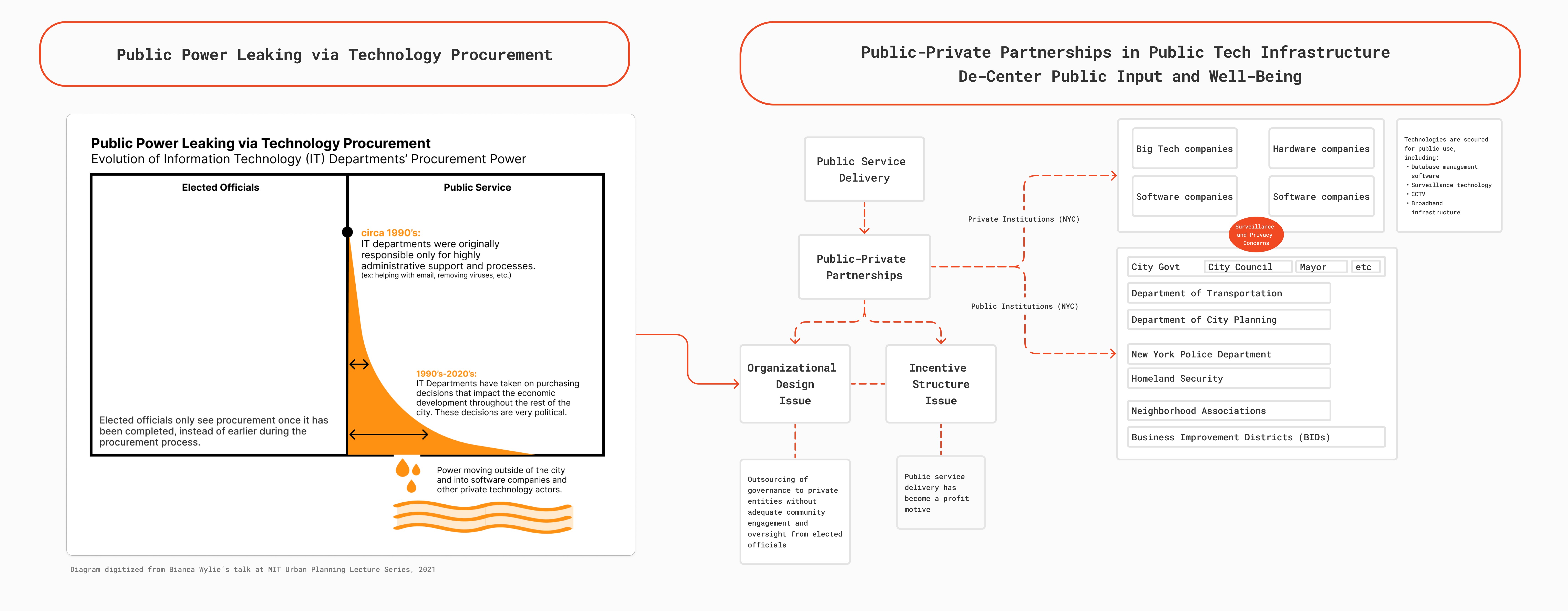
This project seeks to understand how the decentralized tools of Web3 allow us to rethink and restructure urban governance, public goods, and property ownership to liberate us and our physical and digital spaces. The political left commonly espouses narratives that contend the decentralized technologies behind cryptocurrency are techno-deterministic and of the right-wing libertarian agenda. However, decentralized technologies can be embraced for their emergent, plastic, and redistributive qualities. that move power currently centralized at the hands of the political and financial elite, into the hands of the collective. This project asks: “How can decentralized civic frameworks serve as an effective strategy for more equitable valuation and distribution of decision-making, infrastructure, public goods, and property in New York City?”
---------
THESIS: EYES OF THE STREET: SURVEILLANCE FROM ABOVE AND BELOW IN PROSPECT PARK AND SURROUNDING NEIGHBORHOODS

MASTER’S THESIS OF URBAN PLANNING
COLUMBIA UNIVERSITY, GRADUATE SCHOOL OF ARCHITECTURE, PLANNING, AND PRESERVATION
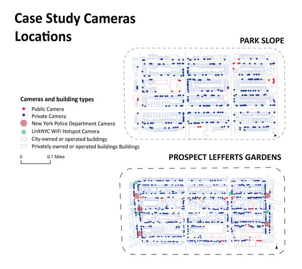
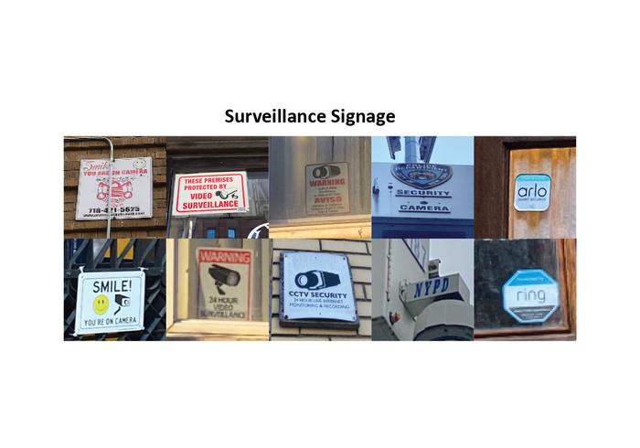
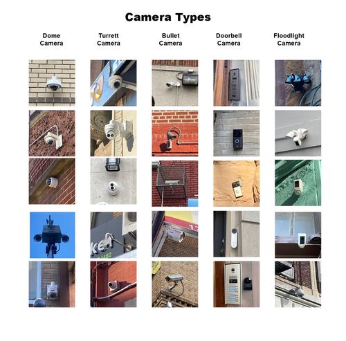
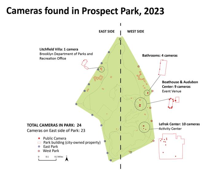
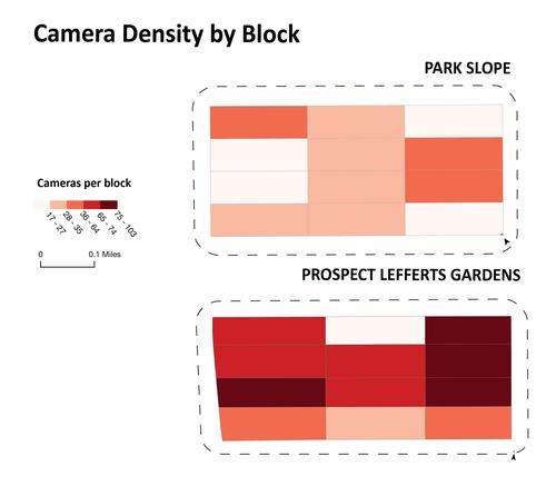
This study investigated the spatial distribution of surveillance cameras (both public and private) in Brooklyn, as it relates to race and class-based demographics.
There are 3 different scales of analysis: 1) Brooklyn borough, 2) Prospect Park and adjacent neighborhoods, and 3) blocks within Prospect Lefferts Gardens and Park Slope neighborhoods. The Brooklyn borough-wide analysis reveals a more top-down systematic deployment of surveillance infrastructure (ex: NYPD cameras, LinkNYC WiFi cameras) which is analyzed in comparison to the more bottom-up deployment of privately owned surveillance (ex: Amazon Ring home security system doorbells cameras). 1,538 total camera locations were collected, mapped, and analyzed using Geographic Information Systems (GIS) methods.
This thesis was presented as a poster at the 2023 Stanford Trust and Safety Research Conference on September 27th, 2023.
----
 TEAM: EDDIE JOE ANTONIO, MATTHEW HEATON, MIA WINTHER-TAMAKI
COLUMBIA UNIVERSITY, GRADUATE SCHOOL OF ARCHITECTURE, PLANNING, AND PRESERVATION
----
LEARNING MODULE: ADVANCING JUSTICE THROUGH BROADBAND AND DIGITAL WORK
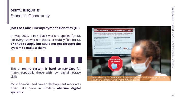
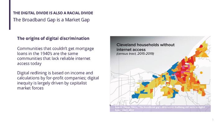
HR&A ADVISORS, BROADBAND EQUITY PARTNERSHIP
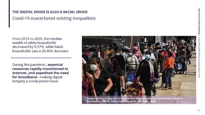
During my time as a fellow in digital equity consulting at HR&A Advisors’ Broadband Equity Partnership, I led research on racial equity in broadband work, which I presented in an internally-distributed learning module.
------
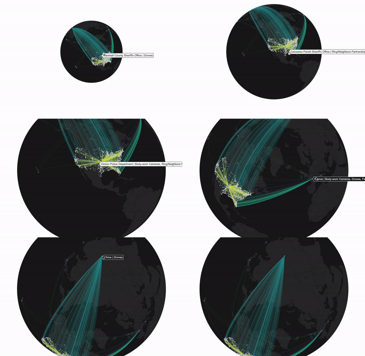
CONFLICT URBANISM
COLUMBIA UNIVERSITY, GRADUATE SCHOOL OF ARCHITECTURE, PLANNING, AND PRESERVATION
This project investigates the US law enforcement’s use of public urban space as a covert tool for a massive data extraction operation, and how it conflicts with privacy in modern urban life. Using python and D3 software, this study visualizes data from the Atlas of Surveillance from the Electric Frontier Foundation (EFF).
----
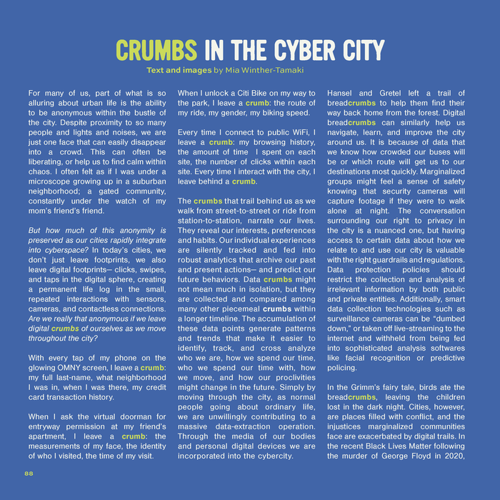
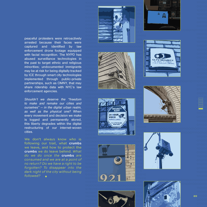
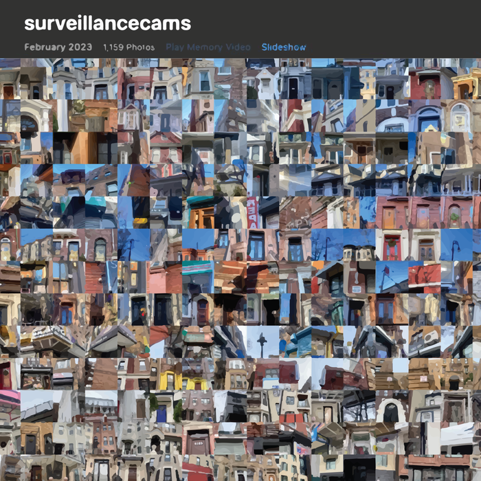
2023 URBAN Magazine
Columbia University, Graduate School of Architecture, Planning, and Preservation
Narrative about the informational ethics surrounding technology-enabled cities and smart infrastructure.
----
RESEARCH + PANEL: SPATIAL ANALYSIS OF THE NYC OPEN STREETS PROGRAM
 INTRODUCTION TO GIS FOR PLANNERS
COLUMBIA UNIVERSITY, GRADUATE SCHOOL OF ARCHITECTURE, PLANNING, AND PRESERVATION
PANEL PRESENTER AT NYC OPEN DATA WEEK, 2022TEAM: SABINA SETHI UNNI, MIA WINTHER TAMAKI
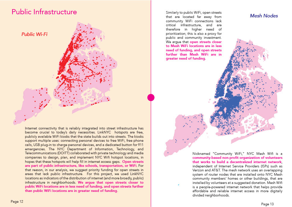
We created a priority metric to identify which of DOT’s existing open streets are among the most in need of funding/resourcing (similar to “priority A” designations). The Department of Transportation (DOT)’s Open Streets program is a form of tactical urbanism where previously car-dedicated streets are repurposed into pedestrian only spaces. However, it is widely criticized for reproducing spatial inequities, rather than resolving them. We argue that one way to address these inequities is resourcing existing open streets, with funding, programmatic support, full-time staffers like community organizers, infrastructure, and more. Our research created a metric (also known as a multi-criteria decision analysis) to determine which open streets the DOT should prioritize resourcing, through analyzing land use, street safety, and public infrastructure. Our analysis suggests prioritizing three streets: (1) Murray Hill’s Barton Avenue (due to proximity to vision zero traffic intersections + potential to expand into the LIRR plaza nearby), (2) East Harlem’s East 119th Street (due to proximity to PS 112 and a GreenThumb community garden), and (3) Mott Haven’s Alexander Avenue (due to proximity to four NYCHA complexes). Finally, as a proponent of critical feminist methodology and participatory GIS, our project also outlines how to reproduce this same research to incorporate other priorities.
Our project was selected for presentation as a panelist at 2022 NYC Open Data Week at Cornell Tech.
----
RESEARCH: LOCATING THE DIGITAL DIVIDE ACROSS NEW YORK CITY
URBAN INFORMATICS
COLUMBIA UNIVERSITY, GRADUATE SCHOOL OF ARCHITECTURE, PLANNING, AND PRESERVATION
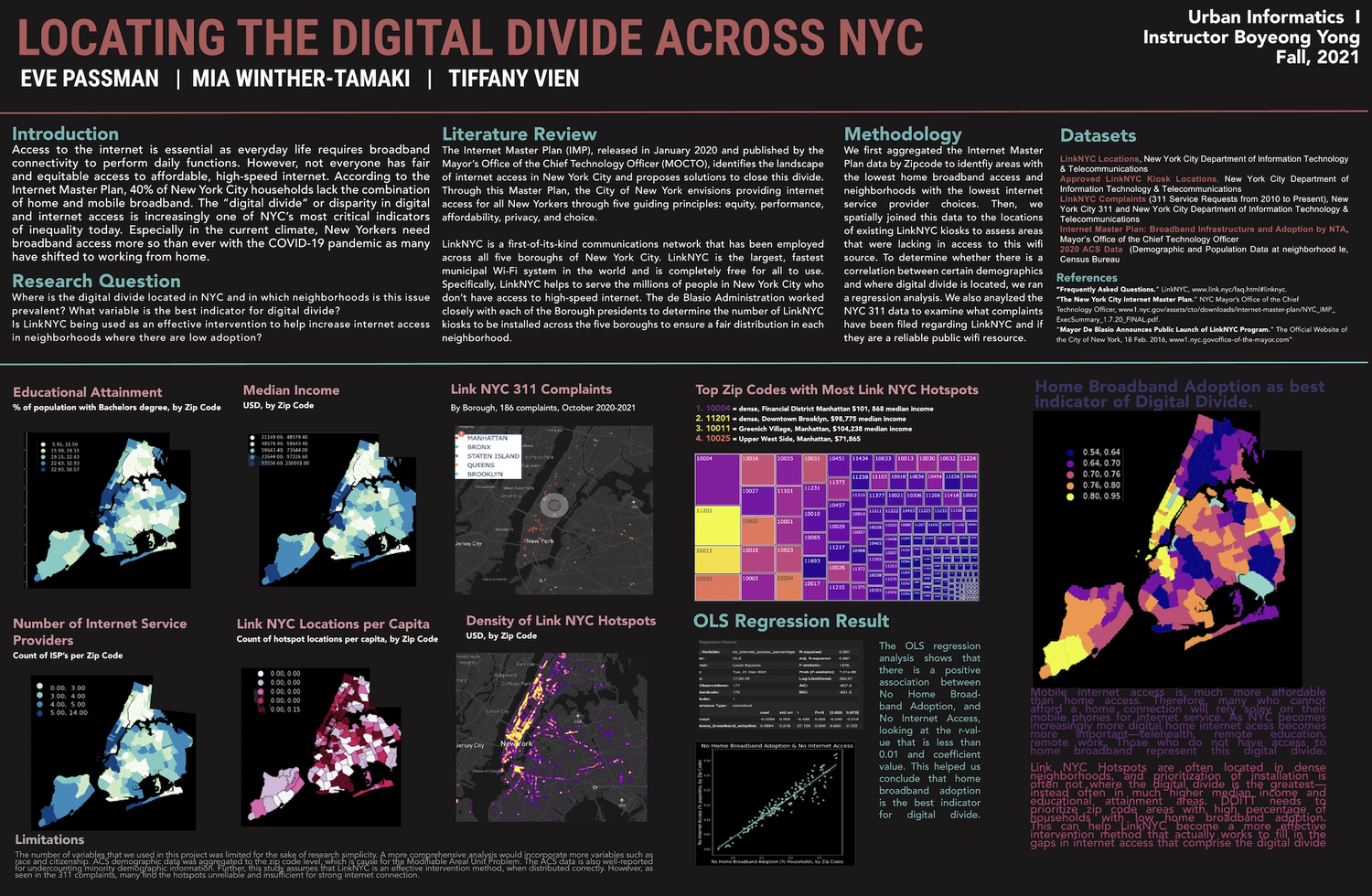
This project identifies the spatial gaps in digital infrastructure throughout New York City. Using publicy available data from the NYC Open Data Portal, we assessed the spatial relationship between neighborhoods with differing socioeconomic and demographic factors, to their proximity to digital infrastructure such as WiFi Hotspots and Internet Service Providers' broadband cable. Using Python programming, we created multiple data visualizations, including a tree and heat map, and conducted a regression analysis.