EYES OF THE STREET: SURVEILLANCE URBANISM FROM ABOVE AND BELOW
EYES OF THE STREET: SURVEILLANCE URBANISM FROM ABOVE AND BELOW
IN PROSPECT PARK AND SURROUNDING NEIGHBORHOODS
MASTER’S THESIS OF URBAN PLANNING
COLUMBIA UNIVERSITY, GRADUATE SCHOOL OF ARCHITECTURE, PLANNING, AND PRESERVATION
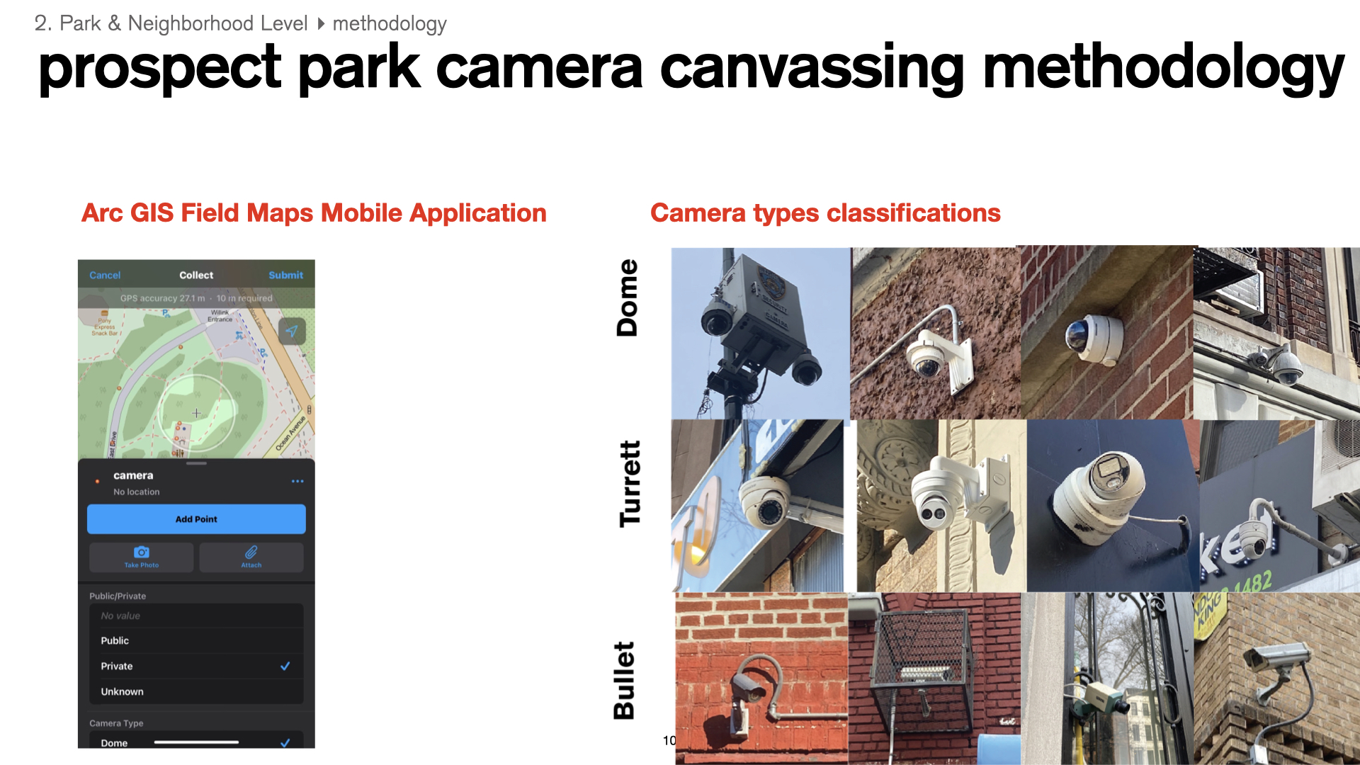
This study investigated the spatial distribution of surveillance cameras (both public and private) in Brooklyn, as it relates to race and class-based demographics. I used three different scales of analysis: 1) Brooklyn borough, 2) Prospect Park and adjacent neighborhoods, and 3) blocks within Prospect Lefferts Gardens and Park Slope neighborhoods. The Brooklyn borough-wide analysis reveals a more top-down systematic deployment of surveillance infrastructure (ex: NYPD cameras, LinkNYC WiFi cameras) which is analyzed in comparison to the more bottom-up deployment of privately owned surveillance (ex: Amazon Ring home security system doorbells cameras). 1,538 total camera locations were collected, mapped, and analyzed using Geographic Information Systems (GIS) methods.
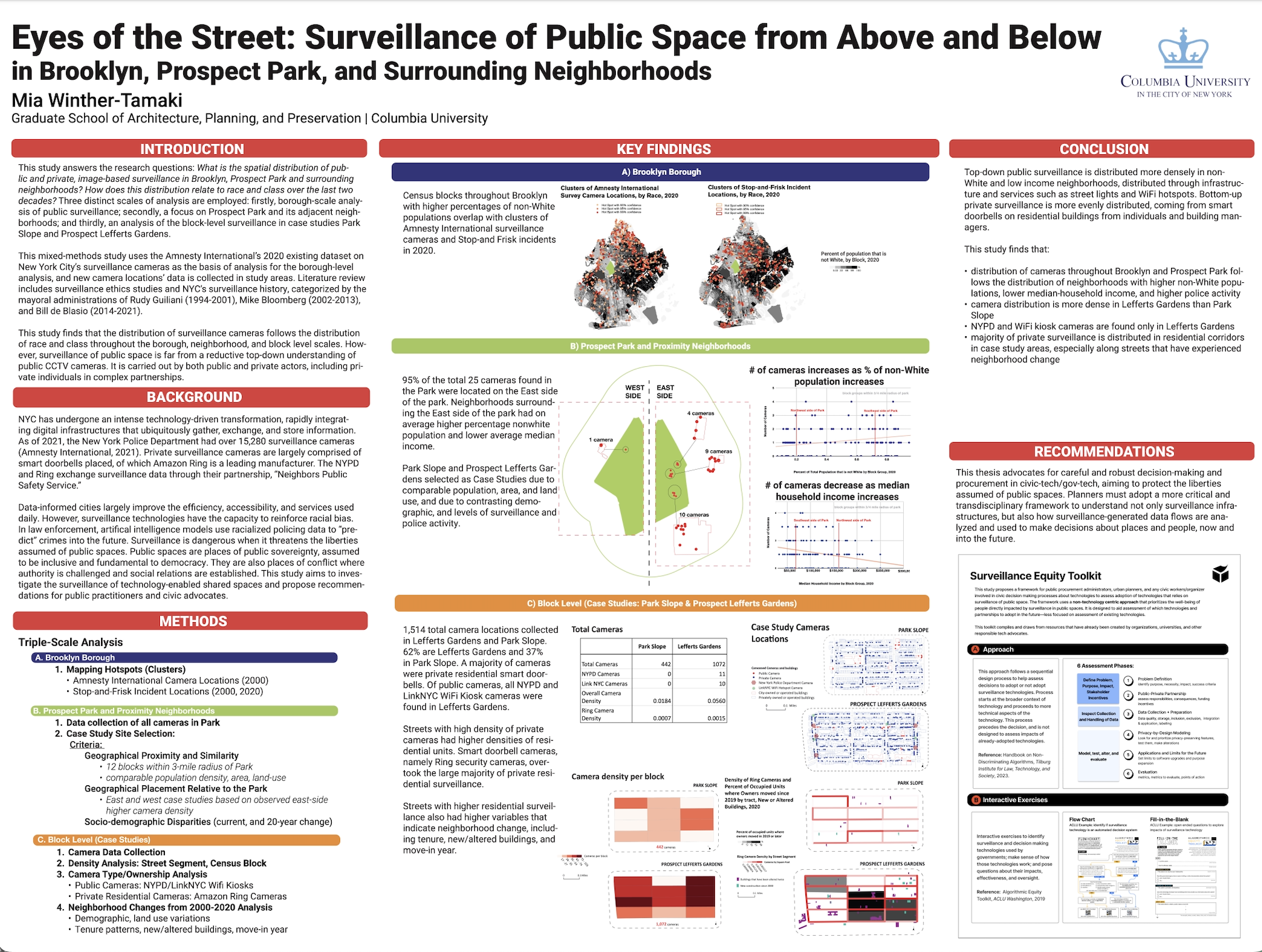
This thesis was presented as a poster at the 2023 Stanford Trust and Safety Research Conference on September 27th, 2023.
----------
FINDINGS
![]()
FINDINGS
A) Scale: Brooklyn Borough
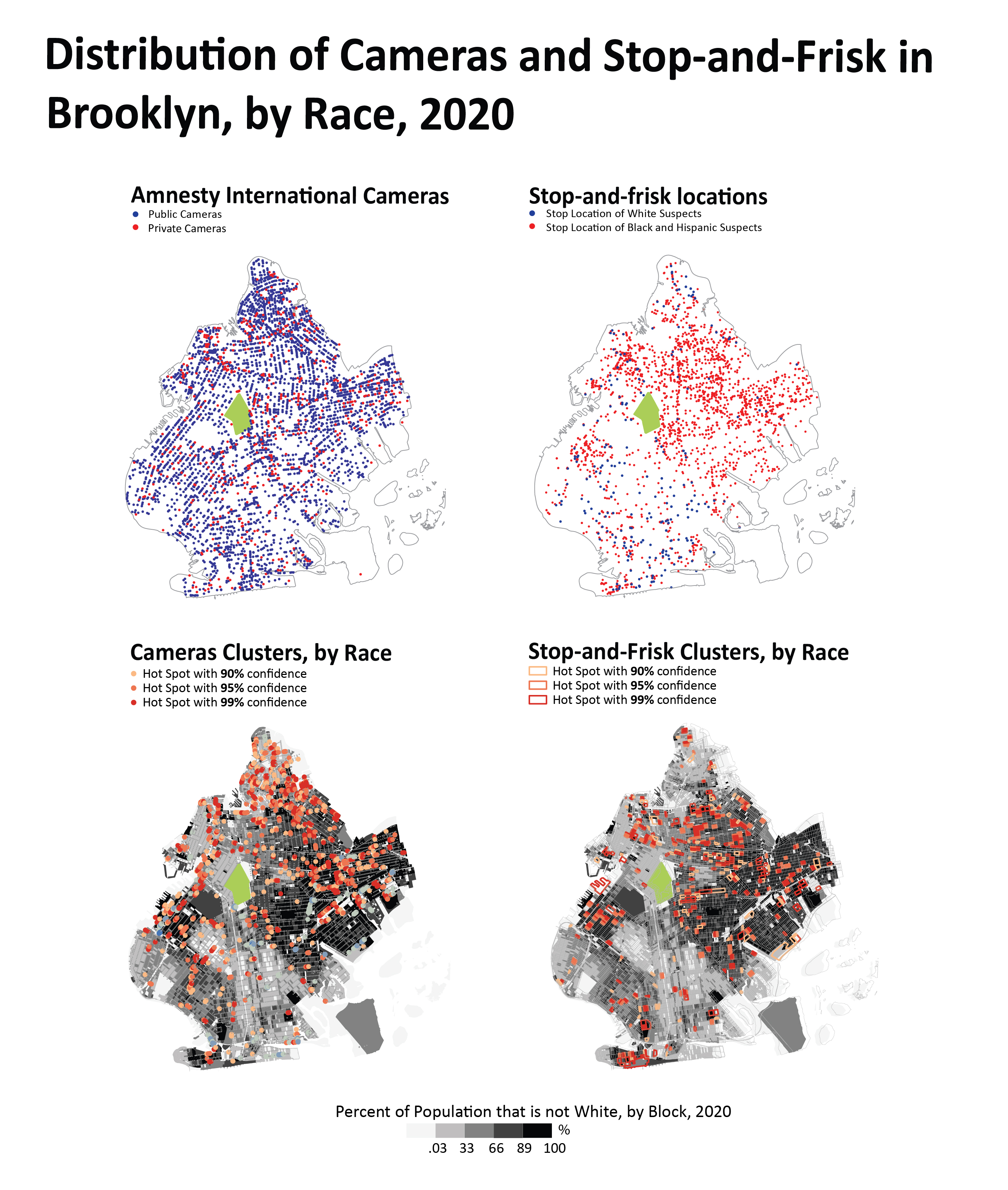
Census blocks throughout Brooklyn with higher percentages of non-White populations overlap with clusters of Amnesty International surveillance cameras and Stop-and Frisk incidents in 2020.
Census blocks throughout Brooklyn with higher percentages of non-White populations overlap with clusters of Amnesty International surveillance cameras and Stop-and Frisk incidents in 2020.
B) Scale: Prospect Park and Surrounding Neighborhoods
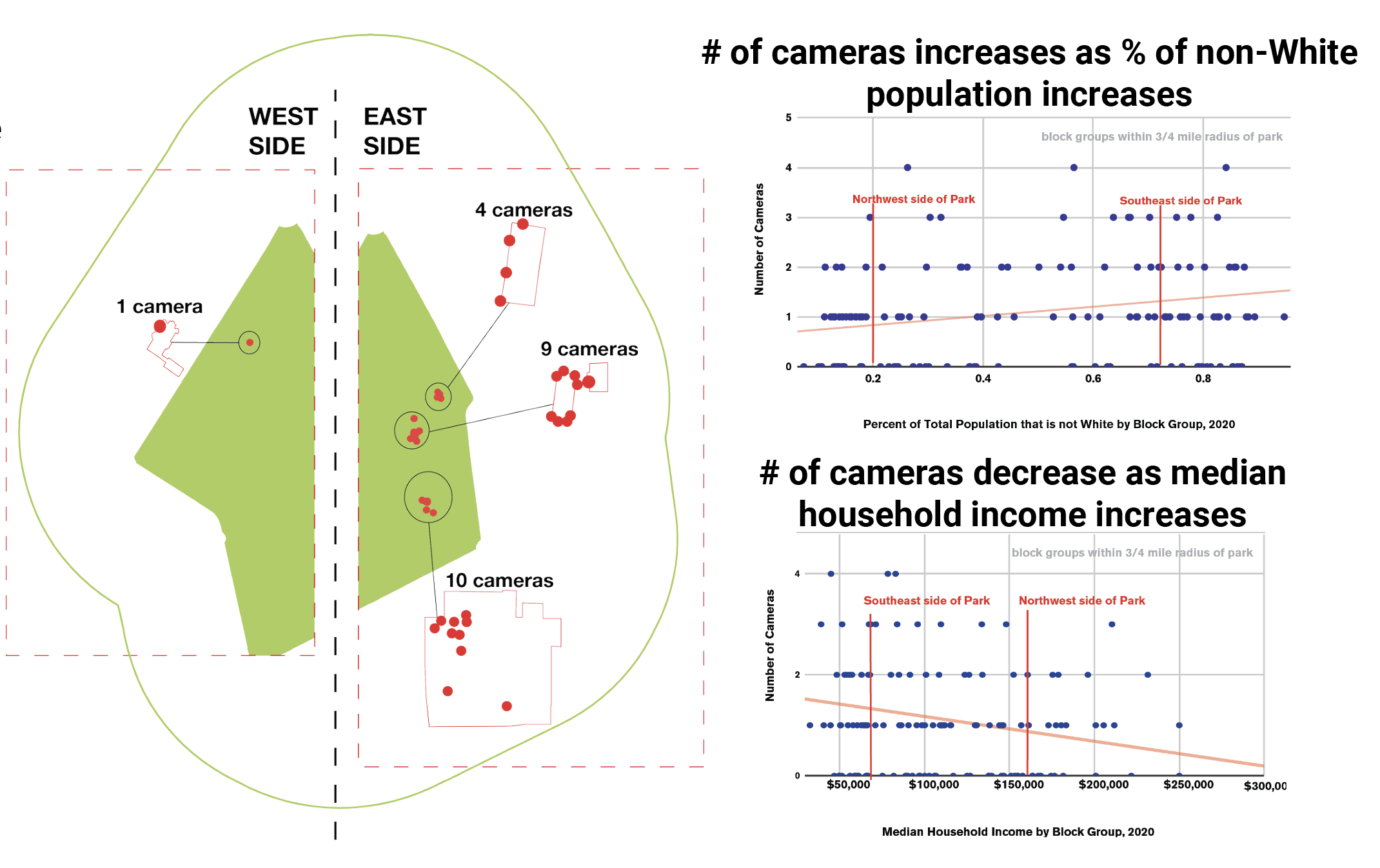
95% of the total 25 cameras found in Prospect Park were located on the east side of the park. Neighborhoods located to the east side of the park had on average higher percentage of non-white residents and a lower average median household income. The number of cameras near the park is linked to the race and income of nearby areas. The race scatterplot shows that as the percentage of non-White population increases, the number of cameras increases. Prospect Lefferts Gardens, with a higher percentage of non-White populations, has more cameras, while Park Slope, with a lower non-White population percentage, has fewer cameras compared to other nearby neighborhoods. In the income chart, higher median household incomes are associated with fewer cameras, and lower incomes in Prospect Lefferts Gardens are linked to more cameras compared to Park Slope.
95% of the total 25 cameras found in Prospect Park were located on the east side of the park. Neighborhoods located to the east side of the park had on average higher percentage of non-white residents and a lower average median household income. The number of cameras near the park is linked to the race and income of nearby areas. The race scatterplot shows that as the percentage of non-White population increases, the number of cameras increases. Prospect Lefferts Gardens, with a higher percentage of non-White populations, has more cameras, while Park Slope, with a lower non-White population percentage, has fewer cameras compared to other nearby neighborhoods. In the income chart, higher median household incomes are associated with fewer cameras, and lower incomes in Prospect Lefferts Gardens are linked to more cameras compared to Park Slope.
C) Scale: Blocks within Prospect Lefferts Gardens and Park Slope Neighborhoods
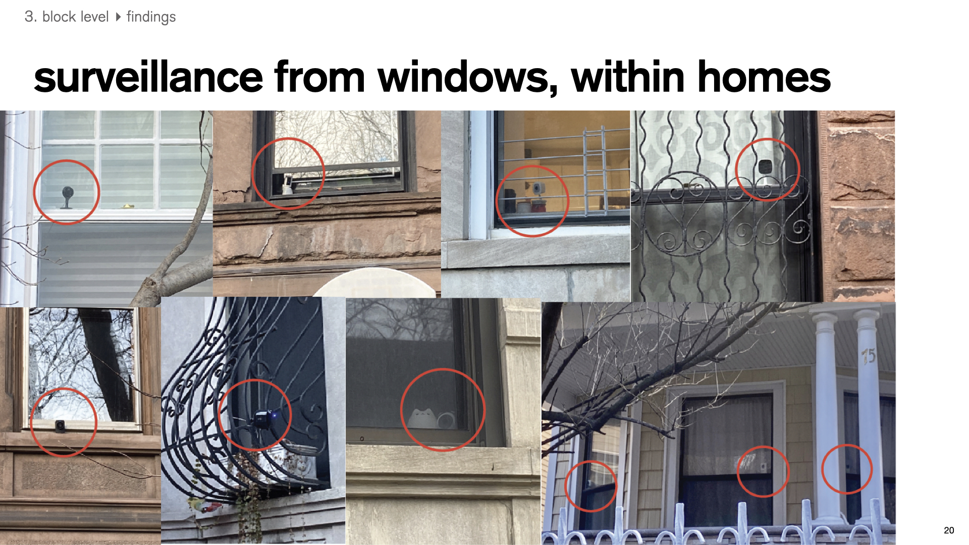
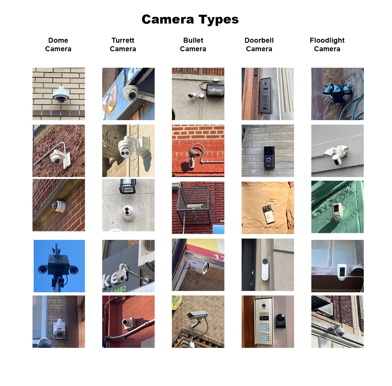
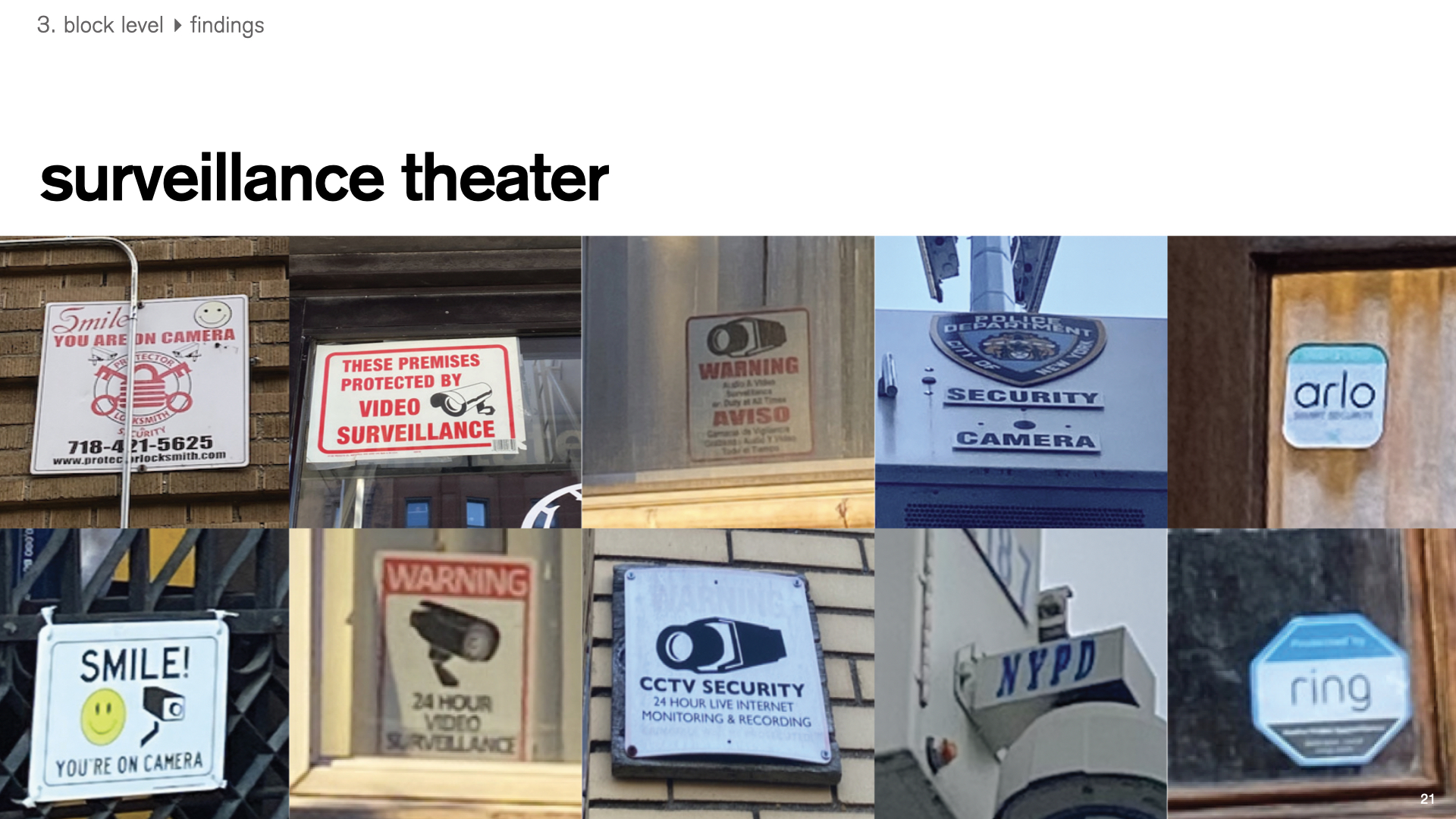
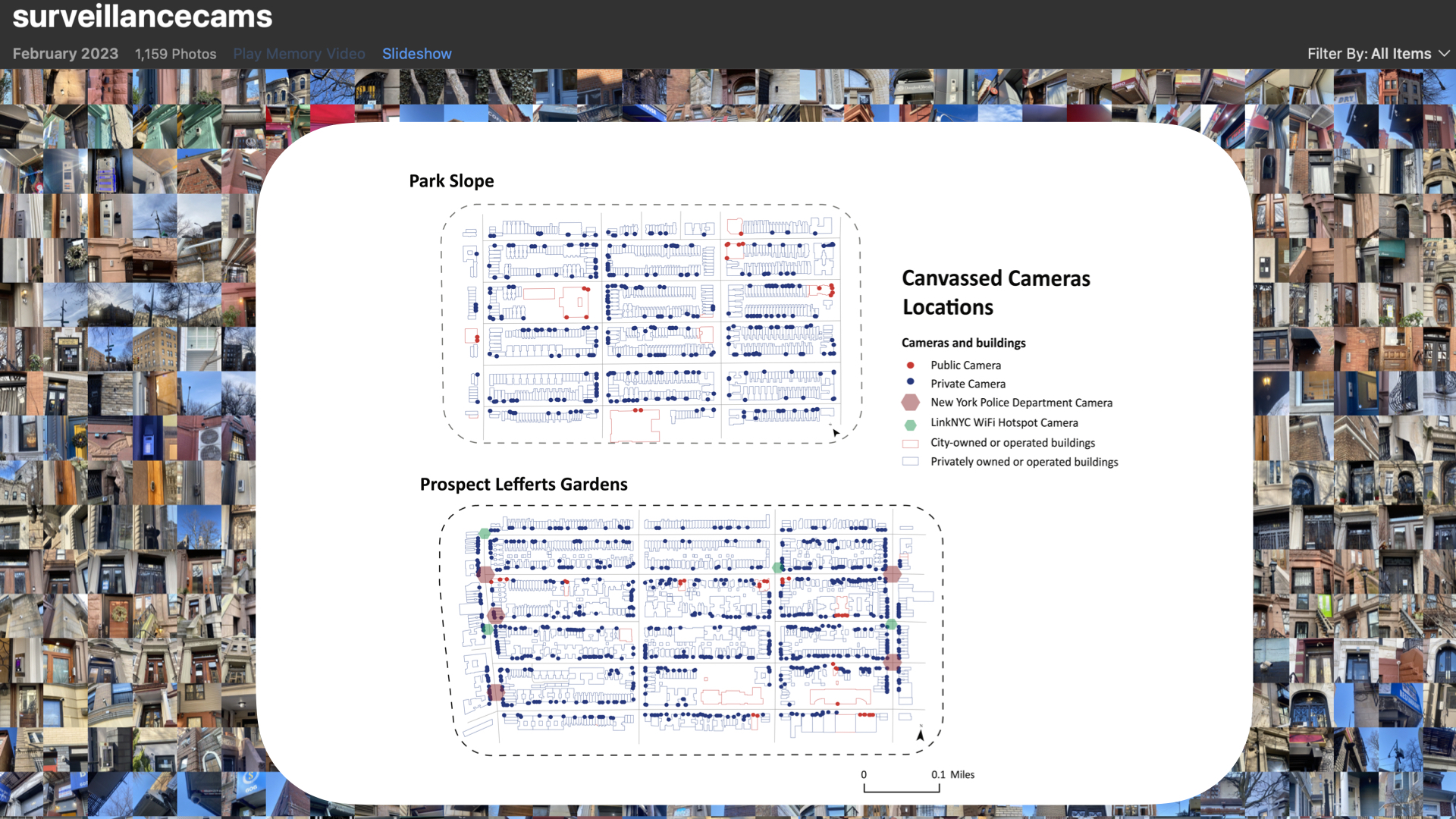
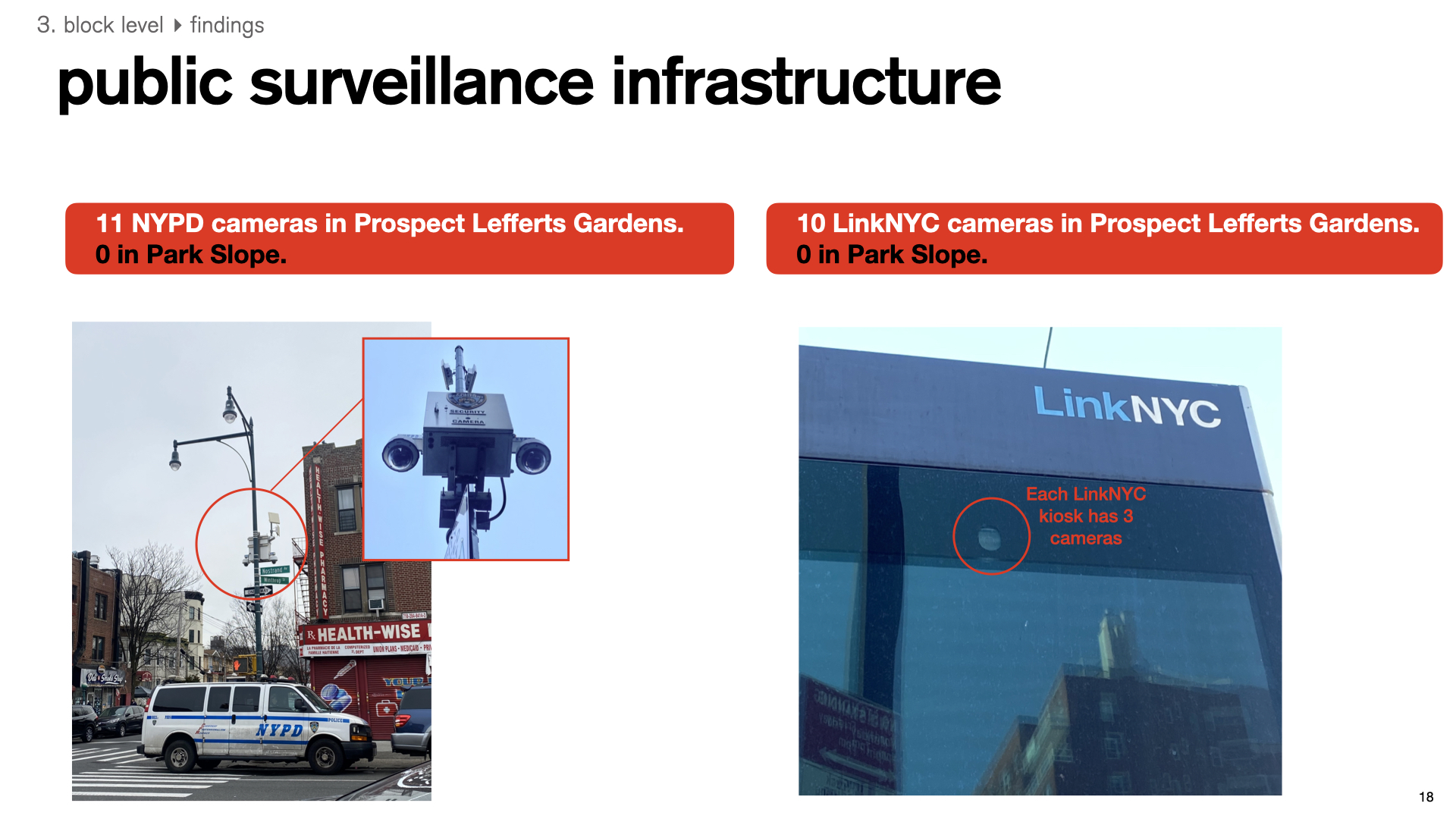
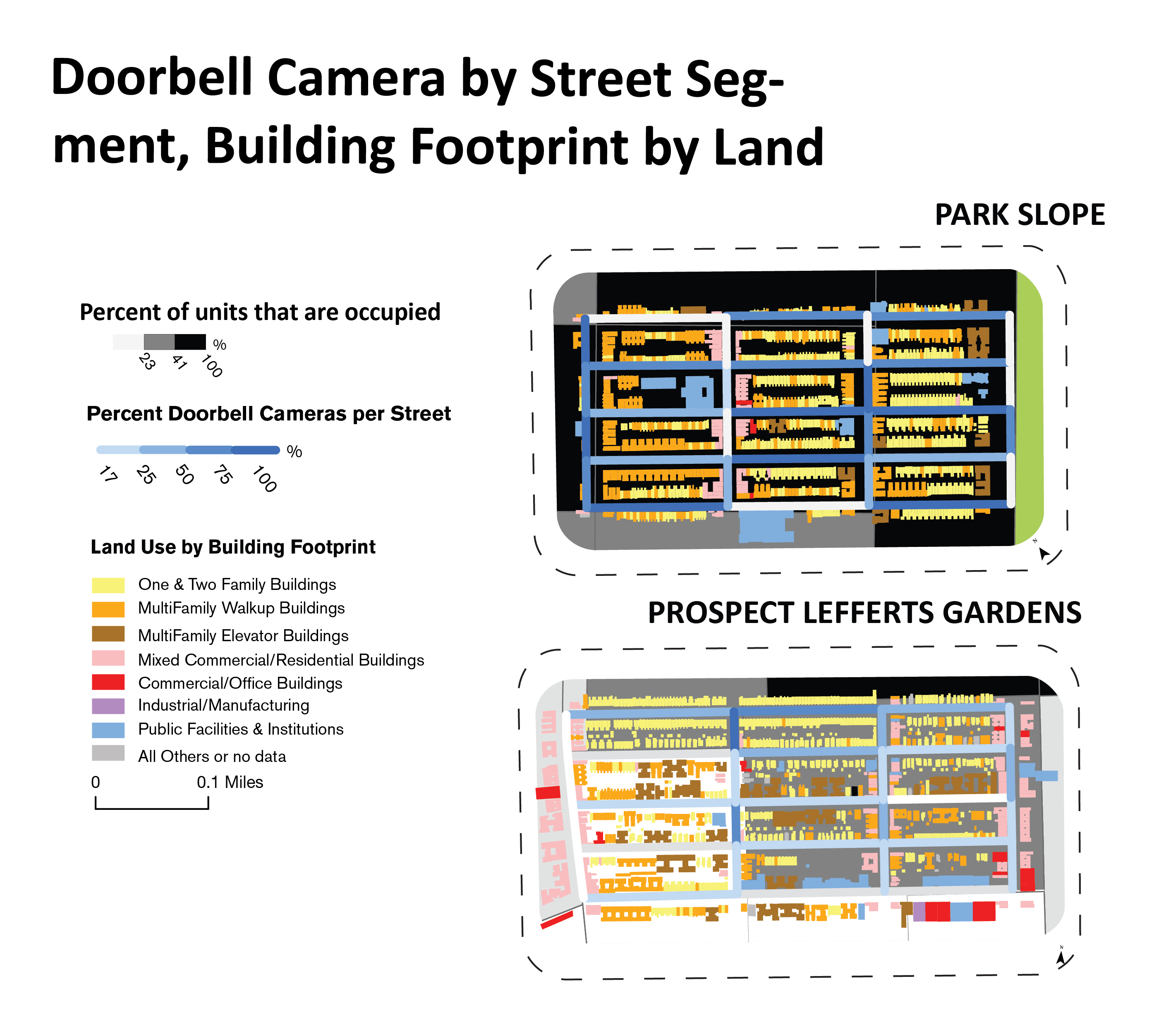
1,514 total camera locations collected in Lefferts Gardens and Park Slope. 62% are Lefferts Gardens and 37% in Park Slope. A majority of cameras were private residential smart doorbells. Of public cameras, all NYPD and LinkNYC WiFi Kiosk cameras were found in Lefferts Gardens.
![]()
![]()
1,514 total camera locations collected in Lefferts Gardens and Park Slope. 62% are Lefferts Gardens and 37% in Park Slope. A majority of cameras were private residential smart doorbells. Of public cameras, all NYPD and LinkNYC WiFi Kiosk cameras were found in Lefferts Gardens.
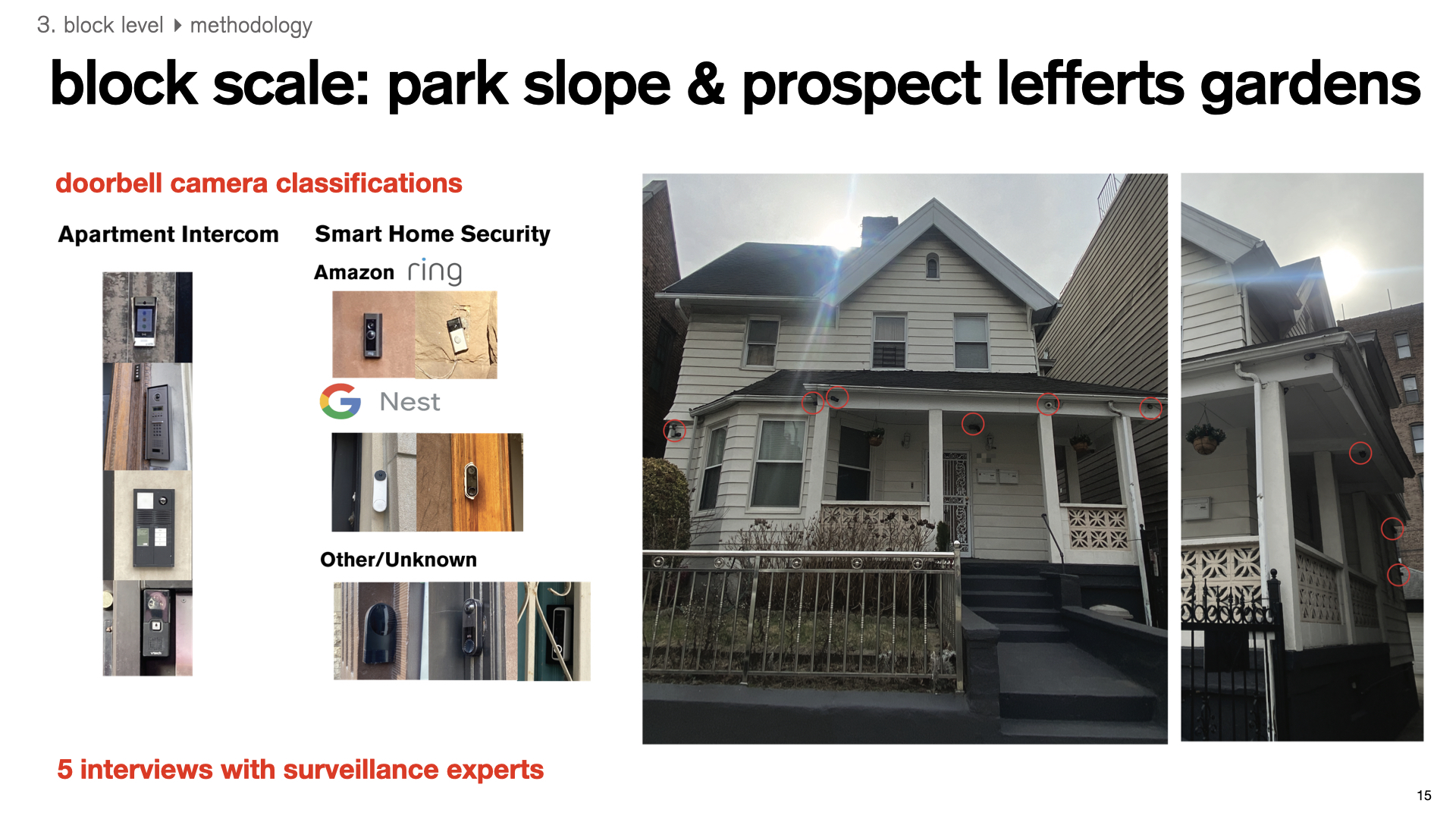

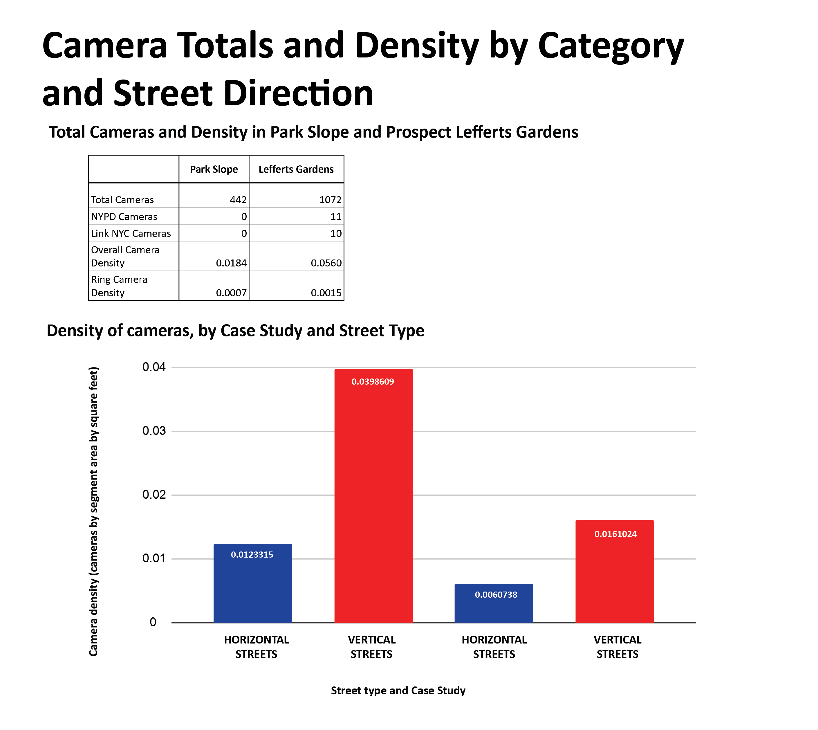
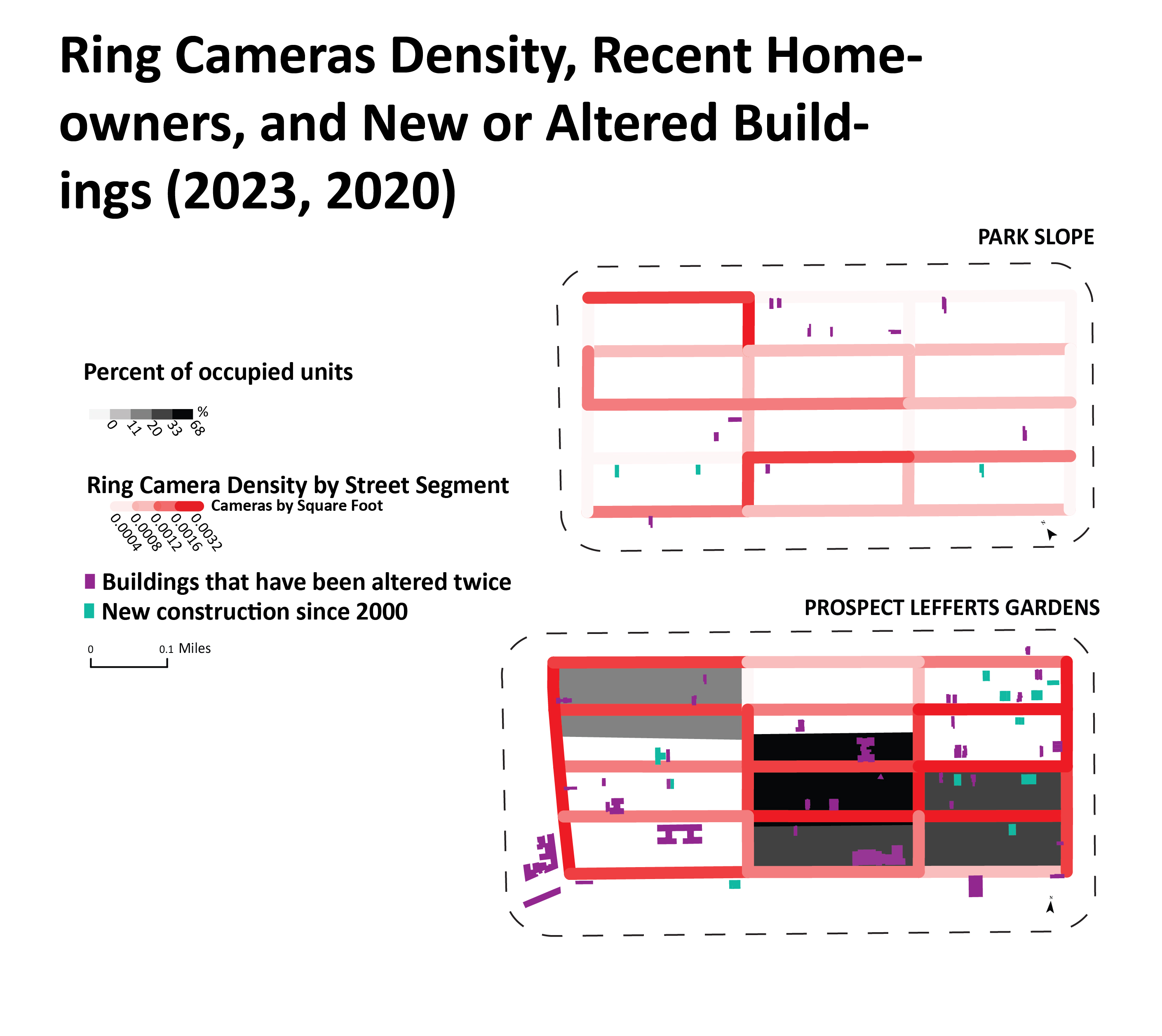
Streets with high density of private cameras had higher densities of residential units. Smart doorbell cameras, namely Ring security cameras, overtook the large majority of private residential surveillance. Streets with higher residential surveillance also had higher variables that indicate neighborhood change, including tenure, new/altered buildings, and move-in year.
CONCLUSION
This study suggests that a lower-income, less White, and rapidly gentrifying neighborhood faces higher levels of surveillance compared to an affluent and predominantly White neighborhood. Additionally, within one of Brooklyn’s largest parks, areas adjacent to lower-income and less-White neighborhoods experience higher levels of surveillance compared to areas adjacent to affluent and majority White neighborhoods.
Public spaces are commons fundamental to democracy—places of public sovereignty where power is contested and social relations are established. While urban data collection has undeniably brought rich analyses and highly responsive services to our cities, this thesis cautions against “smart city” technologies that reinforce racial bias and advantage corporate profits. Surveillance infrastructure is a nuanced and complex interplay between all levels of infrastructure, decision makers, and residents— a “surveillance urbanism” that reflects the dynamic and deeply embedded nature of surveillance in urban morphology.
This thesis advocates for careful and robust decision-making and procurement in civic-tech/gov-tech, aiming to protect the liberties assumed of public spaces. Planners must adopt a more critical and transdisciplinary framework to understand not only surveillance infrastructures, but also how surveillance-generated data flows are analyzed and used to make decisions about places and people, now and into the future.
RECOMMENDATIONS
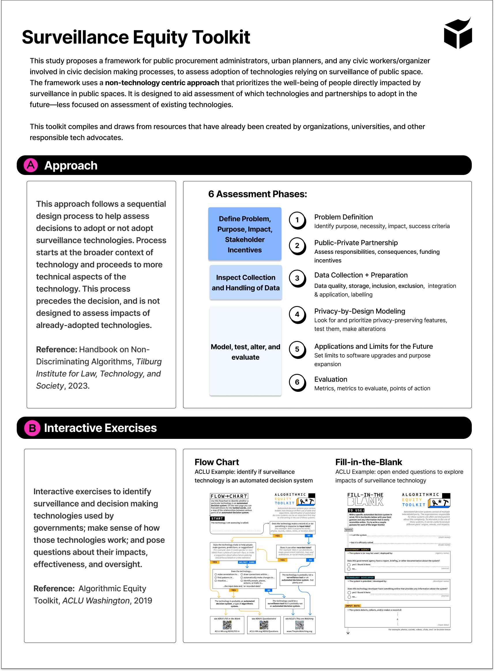
This study proposes a framework for public procurement administrators, urban planners, and any civic workers/organizer involved in civic decision making processes, to assess adoption of technologies relying on surveillance of public space. Often, procurement decisions are made from an administrative and information-technology perspective, which ultimately leaks power from the city into private actor’s hands. The framework uses a non-technology centric approach that prioritizes the well-being of people directly impacted by surveillance in public spaces. It is designed to aid assessment of which technologies and partnerships to adopt in the future—less focused on assessment of existing technologies.
------
Additional images:
